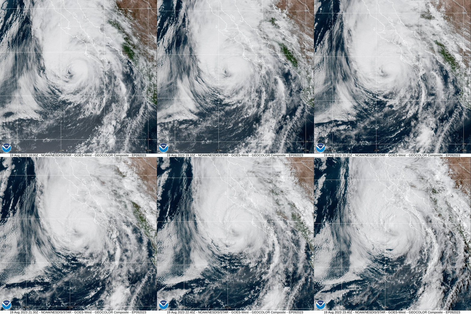
For the past week, there has been a lot of talk about a hurricane hitting Southern California. This hurricane, named Hurricane Hilary, was classified as a category two hurricane on Thursday by the National Hurricane Center. As of Friday, this hurricane has progressed to a fourth category hurricane. With SoCal being an area with a very hot climate, the news of this hurricane has been shocking to residents.
This tropical storm originally emerged on Thursday afternoon off the coast of Mexico in Cabo San Lucas. This hurricane is predicted to reach Los Angeles on Monday morning. L.A. would not be the only place affected by this hurricane. The winds of Hilary are expected to reach Arizona, New Mexico and Nevada in addition to California.
Before Hilary hits SoCal, its winds are expected to reduce significantly, so it’s reported that Californians shouldn’t be too worried. While the anticipated winds aren’t expected to be disastrous, there is still a huge risk of flooding in these regions on Sunday and Monday. It is recommended that the residents of these areas prepare.
The heavy rainfall could reach up to six inches in some areas. This rapid rainfall is predicted to pose a major flood threat.
Environmental Science teacher Ms. Tracy Kim provided some insight as to how this rainfall may affect California’s citizens.
“Right now it’s very unpredictable,” Kim said. “The concern is that California’s infrastructure isn’t made to have a lot of rain so that’s kind of an area of worry.”
Since areas like Los Angeles aren’t used to the idea of rain, our drainage system and the architecture aren’t the best suited for such extreme rainfall.
Hurricane Hilary’s rain may reach some of the hottest places in California, including Death Valley, which may potentially receive around two inches of rain. Hilary’s rainfall may help counteract the ongoing droughts in the Southwest.
As a result of this hurricane, temperatures are expected to drop around 20 degrees from the high nineties.
The last tropical storm to hit California was Hurricane Nora in 1997, so Hilary is the first hurricane to hit California in 26 years.
“This is also a really historic event,” Kim said. “It’s never happened before.”
The unusual approach of this hurricane to geographically warmer areas may be an effect of climate change. With weather conditions becoming more extreme, the possibility of more hurricanes impacting California is increasing.
“The premise you have to understand is that since the dawn of young earth, the climate has been dynamic and constantly changing,” Kim said.
She explains that not everything is set in stone in terms of weather and that there are different trends. While climate change could be one of the reasons for this hurricane, there are other possible explanations.
Kim says that this weather event may be tied more directly to El Niño, a period where the temperatures of the central and eastern regions of the Pacific Ocean start to warm.
“This year El Niño is early,” she said. “For the last two years, it was actually La Niña, which was one of the reasons why we had extra rain. But because of El Niño being early this year, the hotspots have been a little more intense.”
In contrast to El Niño, La Niña is the cooling period of the east-central equatorial Pacific.
As news outlets track the route of this hurricane, it is highly recommended that people in the predicted areas start to prepare.
There are chances for Hilary to advance to a category four hurricane later next week.


